July 31, 2017
GIS and Technological Advances in Archaeology
There’s more to modern archaeology than the old shovel and trowel. With the use of Geographic Information Systems, archaeologists can create maps of land surface down to extraordinarily specific levels, and predict sites for teams to go in and dig. Nick sat down with Stacy Poulos from Maryland’s own Anne Arundel County to discuss the many advances in technology in archaeology including GIS, laser scanning, and the potential future developments like holographic displays of lost buildings! This is PreserveCast.
Guest:
Stacy Poulos
Sponsor:

SUBSCRIBE


FOLLOW


Introduction
[Nick Redding] Archaeology is a field that digs deep into human history, sometimes predating written history itself. And while you still need a shovel and elbow grease at a dig site, the modern application of geographic information systems, or GIS, has revolutionized how archaeologists approach their work. Stacy Poulos from Anne Arundel County is here to explain exactly how GIS, LiDAR, and laser technology, allow archaeologists to predict sites and create maps that are accurate down to the centimeter. Bring your shovels, we’re getting the inside scoop this week on PreserveCast.
From Preservation Maryland Studios in the historic podcast district of Baltimore, this is PreserveCast!
[Nick Redding] This is Nick Redding and you’re listening to PreserveCast. Today we are joined in studio by Stacy Poulos who is the archaeological sites planner for Anne Arundel County’s Cultural Resources Division. And in addition to ensuring that archaeological sites are not impacted by development, she works closely with non-profits throughout the region to develop public outreach opportunities in historic preservation and archaeology, and implements a bunch of research and field projects on local history and archaeology in Anne Arundel County, which is home to the seat, our state capitol, Annapolis. And so we’re very pleased to have Stacy in our studio today, and specifically, we’re going to be talking to her today about Geographic Information Systems, GIS. Good to have you here today, Stacy.
[Stacy Poulos] I’m happy to be here [laughter].
[NR] So, tell us a little bit about how you become the archaeological sites planner for Anne Arundel County? How did that happen? You graduated from college and that’s initially – right where you ended up?
[SP] Nope, it took a few thousand miles and [laughter].
[NR] Where did you start off?
[SP] Well, I started off as an Army brat actually. I was on a base in Ramstein, Germany until I was five, and then we moved here to Maryland and I was always looking overseas. Both my parents were history buffs. And I read, Tutankhamun’s Tomb by Howard Carter when I was eight years old and that was when I knew I wanted to be an archaeologist. That was it. What I didn’t know is that I actually wanted to be an archaeologist in Maryland [laughter].
[NR] Okay.
[SP] – and a preservationist. I went into graduate school for Greco-Roman, Near East and Egyptian archaeology. So I was a Hellenistic archaeologist. I cast a wide net and I spent a few years overseas. And then I came back and I started doing some work in Maryland, and I just fell in love with it [laughter].
[NR] So what kind of work do you focus on prehistoric or historic period?
[SP] It was both, actually. I was doing my dissertation on Hellenistic Archaeology and I came back here to visit with my family and I ended up deciding to change career paths for many different reasons. But one of them was, I just wanted to stay closer to home and wanted to grow some roots. So I got a Master’s in GIS at the University of Maryland, because I love working with huge data sets and I knew I could do a lot with it in archaeology. And then I got an internship at the Lost Towns Project, in Anne Arundel County and –
[NR] And tell us a little bit about the Lost Towns Project, what is that?
[SP] The Lost Towns Project is this amazing non-profit – it’s actually a young non-profit but it’s a project that’s been in existence for the past 20 years. It was started in the 1990s by Alucan Bach and Jane Cox has been involved with it too since the beginning and she’s recently started the non-profit so that it’s now its own entity. But throughout the years they’ve been doing archaeological research and public outreach on history and historic preservation in Anne Arundel County. And in the past couple of years with the birth of the non-profit, it’s expanded to more of the Greater Chesapeake area. So over the years, they’ve been working at sites all over the place – prehistoric historic sites. And so it was an amazing opportunity to start out with them and then to become a consultant with these local non-profits in Anne Arundel County because I got such a wide array of experiences and prehistoric archeology, historic archeology, and architectural history.
[NR] Cool. So tell us a little bit about GIS. Obviously, you know quite a bit about it [laughter]. And I think for a lot of people, if they’ve ever used GIS, maybe they’ve gone to their county or municipality website to try and look up maybe property records or see where the property line is or something like that. And so I think for people who aren’t familiar with historic preservation, they might be surprised to learn that GIS is used quite a bit in the preservation and archaeology fields. What’s the value of GIS? What can you do with GIS? And maybe, even taking a step back, what the hell is GIS?
[SP] I guess we should start with that [laughter].
[NR] Yeah, yeah, yeah.
[SP] Well, I use it every day, all the time and it’s just an absolutely essential tool.
[NR] So you’re a computer archeologist.
[SP] No, it’s an essential part of every single archeological survey now.
[NR] In the field?
[SP] You can use it in the field now too. It’s just the technologies advanced so much that it’s no longer something that’s just constrained to the office. But to start with, GIS is short for Geographic Information System. Some people call it a computer mapping, advanced computer mapping. But it’s even more than that. It’s really a visual database where you can map individual sites or really anything. And each of those points on the map is connected to all this different kinds of data. And it can be its site name, who surveyed it, and in addition to that, it can be overlayed with other types of data. Not just a single point in space; but, you can have historic maps, you can have historic aerials, you can have environmental information, all this stuff stacked on top of each other. Just have a thousand bits and pieces all put together in one little interface and it just gives you so much of a immediate understanding of what you’re looking at.
[NR] So for the value of archeology, it allows you to kind of put all the different context and layers together to see where a site might be. Does it help you find sites?
[SP] There are a lot of different values for it. One is, yes, you can predict where a site might be. This prediction could be based on environmental variables or what you know about its historic usage. If a site’s been mined to extinction and then it’s covered by trees, just walking over, if someone doesn’t know, they might think, “Oh this looks like a pristine property.” But if you look back 10 years in the aerials, you’ll see this place was completely graded so we might not go there to do a survey.
Just that alone too, not just predicting where a site might be. If you have a historic map that says a building used to be here, you’re going to think that might be a good spot to dig. But it also helps you evaluate whether or not the survey is something you should do because of the level of disturbance. Or someone may of already surveyed that area before, and we still run into this. From the 1970s and on someone was traipsing around and digging holes and you can see traces of it. But with the GIS we’re getting more and more continuous streams of data. So people are mapping now where places have been surveyed. So we can go and look at a spot, and we know that that place has already been excavated. We can find the information about it, and that is just so much more efficient.
Additionally, you may have a site that’s humungous. And how do you decide where to dig? With the GIS you can start planning ahead of time. Like this area has the highest potential because it has the least amount of disturbance, the least amount of erosion. Those kinds of questions can be answered before you even go out in the field.
[NR] So why don’t you take us through – I think it would be good for listeners who aren’t really familiar with this to get a sense for… You’re talking about manipulating computer data and I think a lot of us are familiar with that. But why don’t you take us through a project that maybe you’ve worked on recently, or one of your favorites, and tell us how your interacting with GIS, and you get the data. Are you grabbing data in the field and then coming back? Kind of just take us through… This archaeological project gets plopped on your desk, and from beginning to end, how does this all work?
[SP] Oh goodness. There’s so many different projects.
[NR] But we want a good one.
[SP] Let’s see. Why don’t I talk about one that is really kind of important right now and pressing, and that’s our Hazard Mitigation Project. Anne Arundel County is surrounded by 503 miles of titled coastline. It’s surrounded by water. It has the Patuxent River on one side, the Chesapeake Bay on the other. So the flood plane stretches basically all around the county and we have hundreds of archaeology sites and historic buildings that we know of that are going to be impacted by this flooding. So how do you handle a problem that is that humongous? Thousands of parcels, hundreds of sites. So that’s where you start with the GIS. We have data that tells us where the known sites are. So that’s plotted on a map. We have data from NOAH and other government agencies that tells us where the flood plane extends. And we also have historic aerials and also soil data – that’s another important one – the types of soils we’re looking at.
[NR] What will soil data tell you?
[SP] If it’s well-drained, it’s likely the site is intact. Whereas if it’s just a bog or quagmire, you have continuous erosion and whatnot, you’re probably not going to have as much information there.
[NR] And are certain soil types more likely to be lost to erosion as well?
[SP] Yeah. That’s another thing you can look at, definitely. Having that information ahead of time allows us to prioritize which sites we’re going to look at.
[NR] So you’re looking for the ones that are most vulnerable, basically?
[SP] The most vulnerable. Exactly. So that’s a big project, a big regional scale project that we’re looking at.
[NR] And so this is ongoing? This one isn’t done, certainly?
[SP] Oh no. It is the beginning of the beginning of the beginning.
[NR] Okay, so you’ve put this data all together. Now what are you doing with it?
[SP] You can start ranking things in terms of priority; and ,then those pieces fit the information together, so that you can actually create a map that shows your – this one has this many variables. That makes it even more vulnerable. So this is probably a higher priority.
[NR] And then that’s prioritizing actually going out –
[SP] Exactly.
[NR] – and doing some type of field survey where you’re actually digging into the ground. In the terms of what you were talking about before, this is sort of predictive GIS archaeology?
[SP] Exactly. Now that’s more of on a regional scale. Now on a site level scale, let’s take Bacon Ridge, for example, where we were investigating an eighteenth century gristmill. And the ruins are still in existence there along the creek.
[NR] Now whereabouts in Anne Arundel? I know you can’t give us the exact site. But where –
[SP] Where it’s actually County Park, Bacon Ridge Natural Area. It’s just off of [I-97]. It’s near Chesterfield Road, which is a historic road that went from Bladensburg to Annapolis.
[NR] Very cool.
[SP] And the gristmill is actually on historic road atlases dating back to the very end of the eighteenth century and earlier.
[NR] Okay, so this is an eighteenth-century mill site?
[SP] Yes, but it extended into the nineteenth century. So one of the things we can do when you’re looking at just a big forested area, how do you decide how to do your survey besides just tripping around? Which we did do some. We were walking overseeing if we could see any artifacts on the ground. One thing we were able to do is to takeLiDAR our data, and put that into our GIS.
[NR] Now we’ve heard about LiDAR before on this series. But why don’t you refresh all of our memories in case someone missed that episode.
[SP] GIS is so multifunctional now. I was talking about how you can put pieces of data together gather and you can add values to it. But it also allows you to process things like satellite data and remote sensing data. LiDAR stands for light detection and ranging. It’s basically a camera that’s attached to the bottom of a plane and it sends out pulses of light to the ground. The camera has a little computer and it records how long it takes those pulses of light to come back, and you’ll have multiple returns on this pulse of light for this one single beam of light that’s shot down. So your first return of that lightbeam is going to be from the tops of the trees, and then the last return is going to be from the surface of the earth. So with GIS, you can put all these points into your Geographic Information System and then remove all those top points, and then you can actually see the bare surface of the earth.
[NR] So you’re seeing undulations or little divots and bumps and –
[SP] You can see old road beds, trails. Sometimes you can see foundations, which is pretty amazing.
[NR] And I guess your county, Anne Arundel County, purchases this data from a contractor? You’re not out flying the plane?
[SP] Yeah. The county has its own data set. I think it’s a consortium with the sate, I believe… [crosstalk]
[NR] But so you don’t have to go and get the LiDAR date yourself [crosstalk]?
[SP] Yeah. I’m not entirely… I don’t do it myself, no [laughter].
[NR] Okay.
[SP] But there’s a lot of different ways you can get data nowadays. USGS, Earth Explorer has a ton of data online that every user can get. Maryland State has data on their web page too and the Department of Natural Resources. There’s a lot of different ways for people to get a lot of data.
[NR] A lot of public data up there. So with that, it’s also sort of helping you in a predictive sense to find things?
[SP] Yes. Yes. So we’re able to see where old road beds are, which helps us – because historic maps are awesome, but they are not always exactly [laughter] close to reality of where the road bed really exists. So just using those types of information really allows us to narrow down. And we were actually able to find ironstone foundation in the vicinity of the Mill Complex that shows up on the LiDAR data. This little teeny tiny rectangle, which at first you might not notice, but it’s right there [laughter]. And we did a few shovel test pits around that and it has eighteenth century material or early nineteenth century material, all domestic. So we found what looks like a tenant house affiliated with the Old Mill Complex, and that story just keeps unfolding. The whole area is so fascinating with early industrial period of Anne Arundel County and the early industry, gristmills and custom mills and –
[NR] That’s really great. Well, I think this is a good time for us probably to take a quick break. And then when we come back, maybe we can talk a little bit more about how GIS works if you’re actually on site and at what you’re doing on site, and then maybe talk about how things are changing with respect to technology and what could potentially happen in the future? And we’ll do that when we come back right here on Preserve Cast.
Maryland: Mini America
[Stephen Israel] We’re in the midst of another sweltering Maryland summer and here in Baltimore, there’s one classic way to cool down: a sweet Baltimore snowball. For those unfamiliar with this summer treat, they’re distinctly different from snow cones and Hawaiian ice. Unlike the crushed ice of the more universal snow cone, the Baltimore snowball typically consists of finely shaved ice. Once packed into a styrofoam cup, the ice is smothered with syrup. And if the snowball shack you’re ordering from knows what they’re doing, there’s a glop of marshmallow on top.
As the legend goes, Baltimore hands have enjoyed shaved ice since the 1800s. Trucks shipping ice to the South would pass through Baltimore and kids would chase after them asking for shavings. When the kids brought the ice shavings home, their mothers would make flavored syrups such as the Baltimore favorite: egg custard, made out of eggs, vanilla and sugar. Eventually, some businesses caught on, and snowballs were sold as intermission treats at theaters in the summertime as the perfect way to cool down in hot venues that didn’t have any air conditioning. Especially during the Great Depression, making the cheap treat was an easy way to try and make some extra money, and during those times it temporarily became known as the Hard Time Sundae or the Penny Sundae.
Some folks from New Orleans may claim their town as a competitor for having invented the dessert first, but their snowball history only traces back to the 1930s when Ernest Hansen patented a dedicated electric ice shaver. But if you ask me, it’s clear that the Charm City predates the Crescent City as far as snowball consumption. Today the Baltimore-based Cold Kids Company creates hundreds of flavored syrups and electric ice shaving machines making it easy for snowball stands to pop up almost anywhere. And they often do as homemade snowball stands are a familiar sight in Baltimore. Even Baltimore ex-pats have been known to start their own snowball businesses wherever they are, including the Baltimore Snowball, and the Snowball Collective in California, and the Baltimore Snowball factory in Florida. All this talk is too much. I’m going to have to run out and pick up an egg custard. And let you guys get back to PreserveCast.
Do you have questions? We may have answers. If at any point during this podcast you’ve thought of a question that you have for us or maybe one of our guests, we’d love to hear about it. You can send an email to podcast@presmd.org and we’ll try and answer it right here on the air on the next episode of PreserveCast.
[NR] This is Nick Reading. You’re listening to PreserveCast. Today we are joined in the studio by Stacy Poulos, who is the archaeological sites planner for Anne Arundel County’s Cultural Resources Division. And when we took our break, we were talking about predictive GIS, and how it can identify potential archaeological sites, and features on the earth, and how LiDAR works. And how all of these different interesting and complex data sets come together and allow archaeologists to do their work, and add value to their work, and document where they’re doing their work. And one of the questions I had – and I really don’t know the answer to this one – Stacy, when you’re at a site right, because you’re not just always behind a computer screen [laughter]. You actually do go out on sites. When you’re out on a site, is there GIS work being done out there as well? Are you identifying where your Phase One pits are being dug a total station or how is all that working?
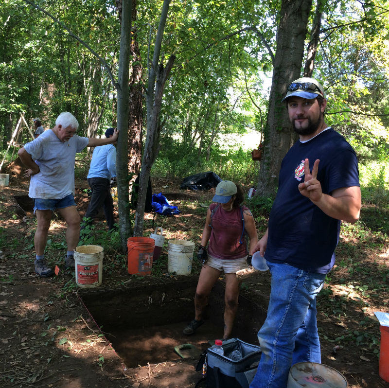
[SP] A total station is great. One of the cardinal rules of archaeology is context. We want to know where artifacts are located and how they associate with other artifacts. And in order to do that, you have to have some kind of spatial reference. And one of the tools that we use out at a site, like we did at River Farm last year with the Archaeological Society of Maryland and with the Maryland Historical Trust, Matt McKnight, terrestrial archaeologist, he took points with a total station for us to map out exactly where our units are. And with that, it’s basically – I guess it’s laser technology. You have a tripod with a little computer device that’s mounted on top of this tripod. And you have someone with a stadia rod. And the tripod sends a signal to the stadia rod to get that point and captures it within the space. And it’s all triangulation and geometry. And this little computer can figure it out. So if you know where one point on a site is, you can georeference or locate everything else in context with that one point. And that one point can put it into the real world for you.
[NR] So this is like a very –
[SP] So you can get it down to a sub-meter accuracy, like centimeter accuracy with this kind of thing.
[NR] So this is like the very fancy, technological version of drawing a map.
[SP] Exactly [laughter].
[NR] You still draw them, right?
[SP] Oh, yes. We loved going old school [laughter].
[NR] So now we’ve heard before that there’s a reluctance to always rely on the digital data that you’re collecting.
[SP] Oh, yeah.
[NR] So you’re always doing a backup handwritten copy. But then you’re also doing the digital work as well. And do you save the digital data [laughter]? How are you guys saving the digital stuff? Has that been a challenge?
[SP] It can be for sure.
[NR] Just the size of it, right?
[SP] Oh, gosh. There is this whole new field called digital archaeology. Because floppy disks were a thing back in the day [laughter] and there are site reports – I’m sure that the Maryland Historical Trust has tons of stuff on file that still needs to be converted over to modern technology. So that’s one of our constant challenges. But I think –
[NR] How do you handle that? I mean, are you guys just backing everything up to the cloud? Are you backing it up onsite?
[SP] Yeah. We have our own server in the county. But yes, we back it up as much as possible.
[NR] Yeah. But that is a challenge that you’re dealing with I guess?
[SP] Yes. Yeah. It always is you know. And I think things are moving towards – with the idea of the Internet server and cloud-based technology is – people are starting to see other ways of translating data so that it’s more convertible. We’re just so much more progressive than we used to be. It’s not so constrained.
[NR] With all of this data that you’re collecting – I mean, obviously, it’s informing archaeology. And really, at the end of the day, you’re an archaeological sites planner. So you’re assisting in the planning process in Anne Arundel County to make sure that if development goes in somewhere – I mean, at the end of the day, it’s to make sure that you’re not losing really important history, right?
[SP] Exactly.
[NR] But how much of this data then becomes accessible to the public? I mean the public can’t see a lot of this because it’s archaeology? What’s the kind of limitations on that?
[SP] Well, there is the Archaeological Protection Act. So, generally, unless it’s on someone’s own individual property, then they do have a right to know if there is some kind of impact that’s going to be happening on their property. Otherwise, the Secretary of Interior Professional Qualifications, the standards for professional qualifications, is that a researcher for archaeological sites should have a Master’s degree. So it’s also to the discretion of the State Historic Preservation Office how they share the data because there may be a need for it. For example, the City of Annapolis, they may need to share data in order to preserve sites that are eroding away just to facilitate the planning process in that sense. But, generally, yeah the archaeological data can be a bit constrained. It is sensitive. We have to be careful with how we share it. And that’s where maps become a really interesting tool to deal with. Because you want to give people the information about the history. But you also don’t want to say, “X marks the spot right here for a Civil War site” [laughter].
[NR] Right. And everything that you’ve just described is extremely precise. Within centimeters, you just described at one point.
[SP] Right.
[NR] So you may not want someone – and I guess for people listening who aren’t familiar with this – really the concern is that someone would go in and destroy a site. Maybe unintentionally or intentionally. But they go in and loot a site and we kind of lose all of that value. Particularly when you’re talking about – I mean we had another archaeologist come in who kind of just gave us Archaeology 101 from Anne Arundel County. And there, we were talking about Native American burial sites and things. I mean this isn’t just “I want to go and collect coins from the nineteenth century.” These, in some cases, are human remains. So you have to be very careful with that. What do you do with maps? Do you just not give them out a lot of cases?
[SP] We just try to be aware of how we present the data. Because if you aren’t giving an exact location, you can give someone a general location. You just have to be sensitive to that. This, I think, is a really good point to bring up. Public archaeology. That’s why we do it. That’s why it’s so important. That’s why the county invests so much time in their partnerships with nonprofits. Because the nonprofits in the county and in the state– they allow for opportunities with the public to do archaeology. And that’s something we think is so important. Because that’s when people understand the value of these spatial contexts, of this association of the data recording. And, generally, it’s worth the risk. Because, generally, the public is really receptive. They understand the value of how to deal with this information in a scientific way. They want to help with that. And telling them that it’s helped us so much because we now have stewards on the ground.
We’ve had this long-term volunteer program that’s been extending for decades. And these people know about the Lost Towns Project. They know to contact them if they find something. Or they know they can contact Jane Cox or me in the county about finding an archaeological site. Then if it’s in danger we can go out and try to do something about it. Or we can document it and then we know that if a building is going to come in we’ll know that there’s a site there we need to deal with first before we lose the data.
[NR] So it’s an important component so that archaeology doesn’t’ become the domain of the professional and confidential information.
[SP] Oh right.
[NR] Because it’s hard to develop community support when it’s like that.
[SP] Yeah. It’s always held confidentially because we need to educate people how to use it. So it’s public history, everyone should know about their history.
[NR] Yeah. So any sense for what’s happening in terms of the future of GIS? What are we seeing? I mean are you seeing some crazy trends or what’s on the horizon in terms of how this technology can be used for historic preservation, archaeology? What should we know about?
[SP] Oh, there are so many different things happening. For one thing, the access to data, I’ve brought that up. Just in the past five years, the amount of data that an individual user or citizen can pull from and build their own database with is incredible. It’s all over the place. Census data, historic records, historic maps, and it’s just wonderful. And there’s also open source software for doing this kind of thing too, like QGIS for example. And it’s so much more mobile than it used to be. You know these apps? There’s a collector apps where you can collect your own point data while you’re out in the field. That’s a mini GIS data system and you can import that into a more complex system. So much of it is now online. People are creating their own interactive story maps and web processing tools that are all plug and play.
You don’t have to do your own coding anymore for a lot of this stuff. Processing satellite data. That used to be so much more complex and now, people have already written code for you that can put into your computer database and just click on it and it’s done for you. Things are just so much more efficient and faster. And also the way people think about GIS too. It’s not just necessarily in the space of great regional context or this is this location in the state of Maryland. It can be spaced within the confines of a building. Like what Mount Vernon is doing with the history of the restoration of that building. Eric Benson has created an amazing GIS database of where they’ve restored plaster over the years within the confines of the house itself, George Washington’s house. And just having that kind of record, it’s just incredible.
[NR] Wow. So that’s like micro GIS.
[SP] Yeah [laughter].
[NR] It’s like GIS at a wall level.
[SP] Right.
[NR] Wow.
[SP] And that’s not even bringing in 3D modeling, which used to be kind of clunky blocks and now it’s becoming something that Hollywood spends thousands and trillions of dollars on creating the CGI environment. And now we’re about to do that for just creating models of historic buildings with LiDAR data, precise- I mean look at what they did with Compton Basset and Wyatt Hall and slave barracks at Belvoir, the reconstruction of a foundation into an actual 3D building.
[NR] Right. And we actually –
[SP] Go Google it on YouTube.
[NR] Yeah. We interviewed those sources and it was our first – it might have been the first episode when we talked to the folks at Elevated Element who did some of the digital modeling for that, which is pretty cool. And they’re a full service, professional drone firm here in Maryland.
[SP] Yeah. I went ga-ga over that. That was pretty cool.
[NP] Pretty cool, pretty cool stuff.
[SP] And then, also Annapolis is doing great things with their GIS dealing with sea level rise. And one of the things we’re talking about is creating holograms. Just down the road, this is one of their adaptation strategies they’re been speculating about. In the event that you can not actually preserve a building– there’s only a few things that you really can do. You can document and say, “There’s no way we can move this building.” You can try moving the building or you just –
[NR] I mean I guess you could raise it.
[SP] – accept the loss. Yeah, or you could raise it. There are certain scenarios where that may not be possible.
[NR] So they’re talking about doing a hologram?
[SP] They’re talking about holograms, which is something you can create with 3D modeling systems and your GIS. You get that data and then to project a hologram out on the water? I love that idea. That’s the future [laughter].
[NR] Wow. Wow. Yeah. We didn’t expect holograms. We’ll have to do a whole separate episode on preservation holograms. Seriously writing that down now. Well, this has been really cool and I think really eye-opening in terms of how this one tool can be really taken advantage of and exploited for archaeology and really increases our awareness of sites and allows us to identify sites, or an important piece of technology shaping the landscape of this field. We don’t let anyone out of the studio without telling us– generally, we ask about their favorite historic site or historic building. In your case, since you’re an archeologist, we’ll let you slide on favorite historic site [laughter], which actually might be harder as an archaeologist, like picking a favorite child. So what would it be?
[SP] Well, there are so many. It’s hard to pick a favorite. I’ll keep it local though, I want to talk about Pig Point. That is definitely an incredible sight.
[NR] I think Pig Point may have come up before. So this is good, I like this.
[SP] Yeah, there’s a reason I wanted to bring it up. Not only is it an amazing prehistoric site. It has the oldest radiocarbon date in Maryland, it’s 9,000 plus years of occupation. It has a Native American burial ground on it that showed hundreds of years of revisitation to it, and this burial ground was 2,000 years old. It’s just an amazing site. Stephanie Sterling and I worked a few years ago on a predictive model of the Patuxent River prehistoric sites, and just using all that data we put in the GIS that we talked about earlier just to see where areas along the Patuxent River might have higher potential prehistoric occupations. And we went out and we did some ground-truthing, as we call it, we tested the model and we found a few prehistoric sites using this model. What was interesting is that Pig Point showed up as not being high potential.
[NR] Okay.
[SP] It was an outlier which just increases my fascination with it because there are so many other questions. It was a unique area.
[NR] So your favorite site is one that completely disproves everything you just told us?
[SP] Yes.
[NR] Okay, good. I like that. I mean that’s obviously the researcher and the scientist in you, who just appreciates the outlier.
[SP] Right.
[NR] But yeah, that does make Pig Point even more interesting I guess.
[SP] Yeah.
[NR] So just adds to the mystery that is Pig Point.
[SP] And it’s also an ongoing research question. So one of the things that I’m hoping to do is to look at all the artifacts within the context and put that into our GIS. Because we have regional analysis, we have analysis within buildings. And we also have that site analysis where you’re looking within a unit. Within, in this case, maybe a burial mound or a midden, an old prehistoric feasting area, and you’re putting all those artifacts into a 3D space to see how they relate to each other. And that’s what GIS can help us with, and we’re working on that with Pig Point.
[NR] Pretty exciting. Well, Stacy, if someone wanted to get in touch with you or they wanted to find out more about what you guys do in Anne Arundel county’s Cultural Resources Division they go to the Anne Arundel county webpage? How do they find you?
[SP] Yeah, we’re in the Culture Resources Division so the short URL is www.AACounty.org/cr for cultural resources.
[NR] Okay, cool. And then I guess maybe the Lost Towns Project, you’ve mentioned that as well.
[SP] Yes. Lost Towns Project has been partnering with us for years with the volunteer program and public outreach. And we have a field session coming up at River Farm, where we’re going to be visiting another amazing prehistoric site. Hundreds of years of occupation. And it’s just down the road from Pig Point, so it’s very complex area.
[NR] Very cool. And how do they find Lost Towns, what’s that website?
[SP] That’s LostTownsProject.org.
[NR] Great.
[SP] And another nonprofit I should give a shout out to is Anne Arundel County Trust for Preservation, who is actually the mother of the Lost Towns Project.
[NR] Okay.
[SP] Back in the 1990s. And they’ve been doing projects throughout the area too, so I just want to thank all the nonprofits in Anne Arundel County for all the great work they’re doing.
[NR] Yeah, we hear this theme a lot. Lot of partnership going on up there.
[SP] Yes. We can’t do it without them. And I just think it’s wonderful, so go out and support your local non-profit, volunteer with us.
[NR] Good point to end on. And thank you for joining us and thank you for all the great work you’re doing out in the field. Definitely one of our state’s shining stars in preservation. Thank you, Stacy, for joining us today.
[SP] Thank you for having me.
Credits
You don’t need to open a history book to find us and available online from iTunes and their Google Play Store as well as our website: PresMD.org. This is PreserveCast.
This podcast was developed under a grant from the National Center for Preservation Technology and Training, a unit of the National Park Service. Its contents are the sole responsibility of Preservation Maryland and the Maryland Milestones Heritage Area and do not necessarily represent the official position or policies of the National Park Service or the National Center for Preservation Technology and Training.
This week’s episode was produced and engineered by Stephen Israel. Our executive producer is Aaron Marcavitch. Our theme music is performed by the band Pretty Gritty. You can learn more about them at their website: PrettyGrittyMusic.com, on Facebook, or on Twitter @PG_PrettyGritty.
To learn about Preservation Maryland or this week’s guests, visit: PreservationMaryland.org. While there, you can check out our blog and learn about what’s current in historic preservation. We’re also on Facebook, Instagram, Flickr, and Twitter @PreservationMD. And of course, a very special thank you to our listeners. Keep preserving!
Show Notes
The Lost Towns Project of Anne Arundel County recently used a Heritage Fund grant from Preservation Maryland and the Maryland Historical Trust to create and release two mini-documentary videos on archeaology programs and projects across the county. You can watch the videos on YouTube and on the Preservation Maryland blog.
Previous episode