September 25, 2017
Building Information Modeling at George Washington’s Mount Vernon
Building Information Modeling (BIM) allows architects to measure elements of a building down to the centimeter, and Tom Reinhart is here to explain how George Washington’s Mount Vernon is expanding on that technology even further to get the most benefit for historic preservationists. What do you get when you cross information from George Washington’s own handwritten letters and the latest tech in data systems and digital modeling? Find out on this week’s PreserveCast!
Guest:
Tom Reinhart
Sponsor:

SUBSCRIBE


FOLLOW


Introduction
[Nick Redding] Building information modeling, or BIM, allows architects and engineers to create digital representations of buildings accurate down to the centimeter. But what can a historic site do once they have a BIM of the structure? Tom Reinhart is here to talk about how George Washington’s Mount Vernon is finding new ways to make the most out of this exciting technology. How can knowledge from Washington’s own handwritten letters inform the data of a digital model? Find out this week on Preserve Cast.
From Preservation Maryland Studios and the historic podcast district of Baltimore, this is PreserveCast.
[Nick Redding] This is Nick Redding, you’re listening to PreserveCast. Today we are joined by Tom Reinhart who is the director of architecture at George Washington’s Mount Vernon where he’s been since 2013. Before that, he was an administrator of architectural research for the state of Maryland and today we’re going to be talking to Tom about all things BIM. But before we define what a B.I.M. or BIM is, Tom, thanks for joining us. Why don’t you tell us a little bit about yourself, how you get involved in this field of work, and how you ended up at George Washington’s Mount Vernon?
[TR] I would be happy to, Nick. So I have always been a history guy even when I was a kid and not just history, but material culture. I started in high school with Revolutionary War reenacting. So I’ve always thought that interacting with the material culture of a particular age doesn’t trump historical documents in any way, but helps bring to life or, perhaps, give a different take on historical information and historical periods. So I think that material culture used in conjunction with historical documentation is really the root to understanding history to the fullest. A very holistic approach.
So I started out in college studying history and then archeology – classical archeology, specifically. And after doing a series of – I have a Master’s and worked on a PhD in archeology – I decided that that really was not where I wanted to spend the rest of my career. So I kind of switched gears and moved into American architectural history. It was so far of a leap given my previous American historical interest; and my specialization in archeology was Greek architecture. So I just sort of re-tooled and got into preservation through the study of buildings.
I went to George Washington University where I had a class with Orlando Ridout V and it was that introduction to sort of that field architectural history, that vernacular architectural approach to buildings. That just lit a fire under me and that’s where I knew I wanted to be. So after my Masters’ at George Washington, I went on to work for the Maryland’s Historical Trust for almost fifteen years and got to see a lot of buildings over the course of that time. And when the position opened up at Mount Vernon, which, in essence, was the first time that they had had an architectural historian on staff, I jumped at the chance of going from an entire state’s worth of buildings an inch deep to having a more limited universe of resources that I could go really, really deep on.
[NR] Yeah. You definitely narrowed your focus. Now you’re focused on one specific building, perhaps one of America’s most famous structures. And what a fantastic structure to work on. So now we know a little bit about you, and are you still crossing the Potomac every day from Maryland into Virginia or have you joined the commonwealth itself?
[TR] Oh no, I’m still living in the Old Line State.
[NR] There we go. What we wanted to talk to you today about is something sort of fascinating, which is BIM. And I sort of buried the lead by telling people that that’s what we were going to talk about. But why don’t you define it for us? Instead of me sort of ham-handing my way through this. What is a BIM? How is it used? And what are you guys doing with it at Mount Vernon?
[TR] So BIM stands for Building Information Model, and it’s a sort of final fruition of the direction of AutoCAD, right? So for generations, buildings were drawn by hand. And then in the 80s, the idea of being able to make drawings of buildings digitally came about, right? And that kind of brought in computer-aided drafting. We went from 2D CAD to 3D CAD and BIM is really 3D CAD that has been tied to a rudimentary database, which holds information about a building or about the materials or products that were used in a building. So it really was developed for the use of architects and engineers for new construction. And I got exposed to it when I was working at the Maryland Trust. My colleagues and I – Orlando Ridout, Marsha Miller – were working on a historic structures report for the Maryland State House. And at one point there was a huge infrastructure renovation project that occurred over a summer and so we had an unprecedented ability to get into spaces that we normally could not get into. So we were on this recordation binge and so we measured, drawing, photographing, taking notes on all parts of the building. And at that time, a firm in Maryland called Direct Dimensions came – and they’re a digital scanning firm, laser scanning firm. They came and demonstrated a laser scan of the inside of the dome of the Maryland State House. And once they processed it, they invited us up to their offices to show us the results of that scan. And the result is what’s known as a point cloud, and so basically it’s a virtual model that’s created out of thousands of little points that have been set in space by the laser beam shooting out multiple times and bouncing back from the surfaces of a building. And they showed it to us, and it was amazing. I mean, the level of detail that you can get out of a scan like that… it’s jaw-dropping. And then they went on to show us what you could do with a point cloud, and one of the things they showed us was BIM. And they showed us just a modern building and they showed us the mechanical, electrical, and plumbing running through a modern building, and it was really fascinating. But it immediately clicked that you could take this technology and retrofit it to a historic structure. And that was something that was already being done. SCI-Arc had already started to collect data on great monuments throughout the world and they were scanning them and sort of keeping that data in case there was some sort of catastrophic loss like those Buddhas in Afghanistan, so that buildings could be – or monuments – could be reconstructed based on these scans, or at least that we would have a record of them. And then there had also some buildings that had been modeled based on point cloud scans. I believe the National Trust did Anderson Cottage in Washington, D.C. But there was that second aspect of BIM, which is the data that is associated with that model.
[NR] And what kind of data are we talking about there?
[TR] For example, for architects and engineers, like if an architect develops a building and he’s using a certain type of Anderson or Pella window – he could associate the manual with that window in the model or he can associate maintenance data with that window. So if you need a certain type of gasket needed to be replaced every five years, that information could be tagged to that window. These models serve as virtual filing cabinets. So you want to know about that window? Instead of opening a drawer and pulling out a file, you go into the model, you click on that window, and it will bring up any data that you have associated with it. As I said, maintenance data or maybe an owner’s manual. So it helps the facilities management down the road.
So over the time, before I came to Mount Vernon, I had read more about what was becoming known as HBIM, Historic Building Information Models, and there was work being done in Ireland by Morris Murphy at the Dublin Institute of Technology. They were scanning streetscapes, recreating those streetscapes digitally. Then, as I said, there was other work being done by SCI-Arc and the National Trust. No one had gone to that second step of taking data associated with these historic buildings and putting them in a data structure. So when I got to Mount Vernon – I was interviewed in 2012 – I pitched the idea that a building like Mount Vernon was certainly worth the effort of scanning, modeling, and then creating that data structure that could hold information that could be associated directly with the parts of the historic building.
[NR] And so then you go about creating this BIM. Now let me ask this, does the BIM always require laser scanning to start? For a historic BIM, would it require that?
[TR] Well, it does not require it. You can hand construct in BIM, and the program that we used was Autodesk Revit, which is a pretty commonly used BIM program. You can hand build. It’s really facile in working the geometry of creating a building, but using the point clouds, I think, streamlines that process a lot and gets you down to a level of detail that is difficult to get through hand drawing. I mean if a wall is out of plumb or has a bow in it, the point cloud’s going to pick that up very easily and very easily translate that into a surface in the BIM. Whereas if you were drawing that by hand – you certainly could – but it would be a much more labor-intensive process. So starting with a laser scan I think just gives you a leg up in getting the model done more quickly, more efficiently, and more accurately.
[NR] And so at Mount Vernon, you started with a laser scan, I presume?
[TR] We did. We scanned everything inside and out, inside knee walls, in between floors and ceilings. We scanned any possible place that we could fit a scanner, we scanned. And as a result, we not only got surfaces – so plaster walls on the interior, siding on the exterior – we were able to get almost every piece of framing. In some way or another, we were able to locate through these scans every piece of framing in the building. And so where we couldn’t actually see framing, we could predict where it was going to go behind a wall or within a wall because we might catch the top and the bottom in two different scans and we could nip them together.
[NR] And how long did that scanning take of a place like Mount Vernon?
[TR] The scanning itself didn’t take very long, but certainly, the modeling took quite some time. So we did – first, we did a pilot project on one room. We had just completed the restoration of the largest room in the house. The new room, which is the big neo-classical entertainment space on the north end of the house. We used that as our pilot project and it’s actually pretty interesting because we knew that we were going to have to update our fire suppression system and I was presenting the results of the pilot study to our board. At the time, at the same board meeting where we were talking about the need to grade our fire suppression system. One of the members of our board said, “We need to do this H-BIM on the rest of the house before we start the fire suppression system.” And that was exactly right.
Having that level of detail in the model and that level of information about the building helps you manage the building on sort of a preservation maintenance schedule, but it also helps you with big projects like modern infrastructure projects because it allows you to lay out the path of that intrusive modern infrastructure virtually through the model before you actually have to get into the building. So if you thought you were going to be able to get through a space with, say, a heating duct and then you opened up a wall and found out, “Oops we can’t get in.” You would’ve learned that already through the model.
[NR] It prevents the exploratory construction phase.
[TR] Exactly, and the prevention of that exploratory construction means – the bottom line is that you are preserving original fabric, which you would have otherwise lost.
[NR] And saving money.
[TR] And saving money. Yes, I mean, you can give it to a contractor. You can make it available. They can do that work on their desktop and not have to be crawling on hands and knees through the building.
[NR] Right, well I think this is a good point for maybe us to take a quick break, and then when we come back talk a little bit more about how this process unfolds in a historic structure, the challenges associated with it, the costs, and what future BIM has in preservation broadly defined. So we’ll do that when we’re back right here in a second on PreserveCast.
Maryland: Mini-America
[Stephen Israel] Tom is joining Nick today, all the way from George Washington’s Mount Vernon. It’s really amazing how well Washington’s old home has been preserved through the years. But talking about Mount Vernon got me to thinking about other aspects of our modern society that might be recognizable to people in the past. And as usual, I’m always thinking about Maryland.
For example, did you know the judges on the Maryland Court of Appeals are the only sitting judges in the United States who wear scarlet robes? Even though the tradition has roots in Maryland possibly as far back as the seventeenth century, it hasn’t always been this way. You see, the first judges in courts in the Maryland colony naturally garnered most of their traditions from English common law and the English court system. And dating back to the thirteenth century at least, English judges were known to wear a variety of different colored robes depending on the season, including scarlet, green, violet, and plain black among others. Eventually, this wide color palette came to be seen as perhaps a little too frivolous, and the Judges Rules of 1635 allowed for much less formal restrictions on judge’s clothing. But still insisted that English judges wear scarlet robes on holy days, as well as the 5th of November to remember the thwarting of the Gunpowder Plot.
It’s not entirely clear why the Revolution Era Maryland General Court decided upon the scarlet robes as opposed to other English variants, but we know that they did. At least, they definitely did in the immediate post-Revolution Era of the late eighteenth century, and Maryland judges were not alone. There are records of courts in Massachusetts, both in Boston and modern-day Maine, wearing red robes to trial around the same period, but at the time, there was no formal decree whatsoever regulating the way judges dressed. It was all just custom. And over the next few decades, the whole idea of robes fell out of favor with judges and the American people, so that by the Jacksonian era of the 1820s, nearly all judges wore business suits on a daily business.
It wasn’t until 1914 when robes really began to make a comeback. And even then, for Maryland, it wasn’t until 1972 when the Maryland Court of Appeals decided to revive the scarlet robes based on Judge Frederick J. Singly Jr., whose research determined them to be a historically accurate way to commemorate the nation’s bicentennial anniversary and the robes have managed to stick around since. Fortunately, there’s no formal decree yet on the color robes podcasters can wear. I personally like getting to mix it up. Anyway, that’s enough about robes. It’s time for you to get back to PreserveCast.
Do you have questions? We may have answers. If it any point during this podcast you’ve thought of a question that you have for us or maybe one of our guests, we’d love to hear about it. You can send an email to podcast@presmd.org and we’ll try and answer it right here on the air on the next episode of PreserveCast.
[NR] This is Nick Redding. You’re listening to PreserveCast. We’re joined by Tom Reinhart who is the director of architecture at George Washington’s Mount Vernon, and we’ve been talking about all things BIM modeling. And when we took our break, we had just wrapped talking about how the process took place at Mount Vernon and how it unfolded. The laser scanning and then the creation of the BIM. So from beginning to end, how long did it take from the idea that “we should really do this at Mount Vernon” to “we actually have an active, usable model”? How long did that take?
[TR] So for us, it took about two years from the planning to actually finishing the red portion of the model of the entire house. So we did that first – did that project – and then we went ahead and did the rest of the mansion. But it wasn’t all scanning and modeling at that point. We worked with Quinn Evans Architects in Washington D.C. as the architects that actually did the execution of the model in Revit to create that model itself. But we also worked very closely with them to develop the data management part of this concept of the HBIM. So we created a data structure that would manage not only the mechanical sort of preservation, maintenance. You know, “we replaced this roof on this day. This window leaked on this day,” that sort of stuff. But we had the idea from the beginning that you’re not only managing the sort of facilities management stuff that you would use a modern BIM on a modern building. We were going to use it to manage the historical documentation associated with our resources.
So if Washington mentioned a room in one of his letters, that reference would get tagged to that room. If we knew that they had re-plastered a certain wall at a certain time, that reference would get tagged to that wall. So we were going to use it for managing Mount Vernon. And as you might imagine, with how prolific a writer George Washington was and how famous he was, so much of the documentary record that he is associated with has survived. We have an amazing amount of primary source material from the time of Washington. And then also since Mount Vernon became a museum in 1860, we have a massive amount of archival information associated with the Mount Vernon Ladies Association’s preservation efforts on the mansion and all of our outbuildings. I mean, we have over a dozen eighteenth century buildings that we manage here. So it’s a big task to comb through all that. We have been digitizing all of that historic record, all of that archival record, and we have begun to group that all together, code it all together, and get it loaded into a content management system, which communicates with the BIM. So the BIM goes – you click on a window, it runs out, and grabs everything that’s coded to that window. And we get the entire history of that particular element in the building.
[NR] Now that component seems like it would – that can’t possibly be done yet, is it?
[TR] Well, not loading all the information is. So in working over the course of that two years, in addition to actually modeling the building, we created a very detailed hierarchy of how this information was going to be laid out. And one of the things that we also did was – Revit is like any kind of high-concept software, you need to be trained to use it. And it’s really great for modeling. But the data, the accessing of data is a little clunky. It’s just not as intuitive as you would want it to be. So we knew that we wanted to create a more intuitive user interface. We looked out around to see what our various options were. And what we found to be the most exciting and the best-received option was placing the model in G.I.S., Geographic Information Systems. So basically digital mapping. And Esri is sort of the big company that developed ArcGIS. And they were very interested in helping us bridge the gap from Revit to the user.
[NR] And so they use a story map to do that?
[TR] No. No, we don’t. We actually use a web scene. So the information travels into a web scene, which means that the user can access the data from anywhere as long as they have Internet access. And so that we can get this model out to contractors, we can get this model out to the public, our visiting public. And we can limit what sorts of information is available. So we don’t necessarily need our visitors to know what our air conditioning settings are. But they want to know all the information from the Washington era about a particular space. So it allows us to really fine tune what information is getting to various people. So we did the proof of concept for that. It works. Now our next step, which we are trying to raise funds for right now, is to polish up that user interface so that we can actually get it out there onto the Web. We are also continuing to digitize data and upload all that data. So basically, we concentrate on one room at a time. As we do restorations, we get all that information into the HBIM.
The other exciting thing that we did or the conclusion we came to while we were doing this work was that this hierarchy we created since we had tied the model into GIS, we weren’t just limited to buildings anymore. We can now manage our historic landscape including archeological resources, horticultural resources. You can go out on the estate and click on a tree and find out what species of tree is it, when it was planted, is it a Washington tree that survives. You can click on an area of the estate and find out the archeological history of that area as well and see all the associated documentation with it. So it’s not just limited to buildings now. So instead of calling it an HBIM, Historic Building Information Model anymore, we’re kind of toying with the names right now. We’re with HBIMS, Historic Building Information System. I don’t think we’re quite settled on what we want to eventually call it. But, basically, it’s an entire historic site management system that we’ve been able to create.
[NR] And this is, I presume, Washington’s Mount Vernon is the first place really to do this. And then, I guess, I would suggest and maybe ask you, is Washington’s Mount Vernon the best-documented structure in the nation or the world?
[TR] I think we are pretty – we’re up there. I wouldn’t say we were the best necessarily because I can’t say I have –
[NR] Who would beat you? I got to know [laughter].
[TR] I don’t know. But I don’t want to make anybody feel bad.
[NR] Maybe the White House? I don’t know.
[TR] Yeah. Maybe. Maybe the White House. Well, although, not much of the eighteenth century White House survives. And we’ve got an extraordinary level of survival of historic fabric here because we’ve been taking care of it since 1860 where most sites were not taking care of their historic fabric until much later.
[NR] So what is the future of all of this? I mean, you guys have created something that’s really fantastic. And you’re too humble to say that you’re probably the best in the world at this, but I think you probably are. A lot of different folks that you’ve mentioned, either we know like Quinn Evans, or we’ve had Direct Dimensions on to talk about laser scanning and those sorts of things. We’ve talked with Rob Schenk also from Mount Vernon about sort of the computer modeling and augmented reality options with Washington’s Mount Vernon. But where does BIM modeling go or BIMS or whatever you’re going to call it? I mean, is this something that you guys are going to license and unleash on the rest of the world and see what people do with it? Or what’s the next step for all of this? It seems like you’ve gone pretty far. Can you go further?
[TR] Well, I do think you can go further. I mean, I think as Rob Shenk I guess said, you can use this for as a virtual tool. You can bring Mount Vernon into classrooms for kids. But really, from our aspect in the preservation department, I mean it just gives us an ability to react so much more quickly and thoroughly to issues as they arise, management issues. Sometimes you have to act fast in historic preservation. You get a leak, something unforeseen happens, and you need information quickly, and this really streamlines it. But I think for the preservation community, what this does is it shows what’s possible. Mind you, being the first, and also we’re cognizant that of the fact that we’re Mount Vernon and that we do, because of our position as a very early preservation organization and also one of the most heavily visited organizations and successful, we feel we have an obligation to the rest of the preservation community to just sort of be the one to take some of those risks out there and lead the way. For the creation of our BIM, our HBIM system, it probably cost us about $250,000 all in all.
[NR] That actually seems kind of reasonable, considering all that you’ve done.
[TR] Exactly. And I will say that we went to great extent to be as accurate as possible. So for example, I know that the folks at Quinn Evans – our staircase, when it was put into the model, I mean, basically, that was hand-drawn because there was no standard objects in Revit for them to just create a staircase. It really had to be hand-done. I think for other sites in the future, they won’t necessarily need to go to that level of detail because we really did see this as sort of the Cadillac version of it. But you guys can do a more affordable version and still get the same results and the same abilities that we have with the BIM that we develop.
[NR] And have you seen any other historic sites start doing that?
[TR] Certainly Quinn Evans worked with the State of Michigan. The Michigan State Capitol has one. And I know they have been involved with some other sites, some other historic sites, perhaps Monticello was thinking about this. I think the Alamo was thinking about it. So I think there were other places around that are looking at it and starting to see what it really offers them. I know that out in, I think – I can’t remember which university it is off the top of my head but – they were starting to use eighteenth-century pattern books to create standardized eighteenth-century objects for use in Revit. So historic houses could then – house museums could then very easily create models that didn’t require a lot of hand-drawing time by architects. They could take kind of the standard eighteenth century baluster in creating their staircase. But that stuff just wasn’t in existence when we did ours. So I think it’s just going to become more affordable. I think it’s going to become more widespread in the preservation community because it really helps you do your work efficiently and effectively. And those are two really important things, especially when you don’t have – when you’re living from fundraising campaign to fundraising campaign, right?
[NR] Right. So let me ask you this, sort of wrapping this up on BIM and then sort of maybe moving beyond BIM, even, what can people expect from Tom Reinhart and the whole architecture team at Mount Vernon next? I mean, is it to continue on this path? Any other cool projects that you guys wanted to let us know that you guys are working on?
[TR] Well, we’ve got a lot of infrastructure projects. We’re about to put in a new fire suppression system. That should start about… that should start up early next year. We also are going to do a major restoration of the cellar of the house, which hasn’t really been touched in way of restoration as of yet. So we’re just kicking off a major study of the space, both engineering and architectural study of it. Also, probably a lot of folks saw that we got hit by a very, very big storm on August 11th, and part of the east slope of the hill that the house sits on collapsed, so we are really scrambling right now to start to move forward to start to understand the geotechnical issues of the soil that the house sits on so that we can prevent any further events like that happening and potentially threatening not only the house, but the rest of the historic landscape that Washington built here in the eighteenth century.
[NR] Yeah, I saw those images on Facebook. Is it known as the ha-ha wall?
[TR] Yes.
[NR] And why is it known as the ha-ha wall?
[TR] When you look at eighteenth century sources, it is known either as a Ha-ha wall or as the Ah-ha wall, and that one makes a little more sense. It’s a wall that is sunk to grade on one side, and then stands above grade on another side. So it’s like a step down. Sometimes that step down would be accomplished by creating a ditch. But it’s there to prevent livestock from getting onto lawns. And so we have a ha-ha that runs on all four sides of the center part of the estate. And the idea of ha-ha, or ah-ha, is that you’re having your leisurely stroll across the lawn and then suddenly, “Ah-ha! There’s a wall and a ditch here that I couldn’t see.” So it doesn’t mar your view. And I think that’s the origin of the name.
[NR] Good little trivia fact as we wrap up here. If people want to learn more about what you guys are doing at Mount Vernon, particularly in architecture, how do they find out? Can they find it on the web?
[TR] Yes. On our website we have information about our most recently completed project in the blue bedroom, The Blue Room. And we are currently working on a restoration of the really high-end entertaining space of the early part of the house, the Front Parlor. And you can go on there, we have information about what we’re doing. We have a web blog and we have other information as well. So just log on to the website and type in “front parlor” and it will get you to that, and Blue Room it will take you to the wrap-up documents for the restoration we just finished.
[NR] Great. And Tom, this is going to be a tough question for an architectural historian, but we ask it of everyone who comes on PreserveCast. What is your favorite historic building?
[TR] Well of course, Nick, my favorite historic building is George Washington’s Mount Vernon.
[NR] Right. And you were paid to say that?
[TR] [laughter] I wish. I’ll be looking for the check in the mail. If you wish to know what my favorite building in Maryland –
[NR] Sure, let’s go there.
[TR] – is, that’s a little bit more of a different prospect. Of course I love the Statehouse, I spent 10 years working on that building. But there are just so many fabulous buildings for so many wonderful reasons. A great plasterwork that would be Chase-Lloyd, amazing, unique survivals would be Doughoregan Manor, which is just outstanding private residence in Howard County, as well as Carroll Hall, one of the greatest neo-classical building interiors I’ve seen. I would say that every building teaches me something, and that’s why I have so many favorites. And sometimes it teaches you – it gives you, for example, opportunity to see something amazing like Chase-Lloyd or Doughoregan. But sometimes it allows you to see things that are kind of small but significant. Like I did work at 40 Cornhill Street in Annapolis and the plaster ceiling, which it’s a shop-dwelling house combination. And the plaster ceiling of the counting room in the back of the shop was taken down and you could see the underside of the floorboards, which were 18th century so they were gauged and undercut to make them all level out on the floor joists. And surviving were the chalk lines that the carpenter in 1770 had drawn on them in order to adds out the bottom of the boards to make them sit level on the floor joists. That you could see that chalk that the carpenter used to help do his work in building the structure, that’s the kind of stuff I live for. You can be so in contact with an anonymous person from 230 years ago. It’s just – that’s why we do this.
[NR] That’s really fantastic, and just really exciting kind of stuff. And sort of those exciting “ah-ha” moments, I guess you might say.
[TR] Yes, yes [laughter].
[NR] So, Tom, it’s been a pleasure. We really appreciate having you on PreserveCast, and thanks for all the good work that you’re doing not only for Mount Vernon, but as you say, for the broader field of preservation. Really outstanding work happening there on the Potomac. And thanks for joining us today on PreserveCast.
Credits
You don’t need to open a history book to find us and available online from iTunes and their Google Play Store as well as our website: PresMD.org. This is PreserveCast.
This podcast was developed under a grant from the National Center for Preservation Technology and Training, a unit of the National Park Service. Its contents are the sole responsibility of Preservation Maryland and the Maryland Milestones Heritage Area and do not necessarily represent the official position or policies of the National Park Service or the National Center for Preservation Technology and Training.
This week’s episode was produced and engineered by Ben and Stephen Israel. Our executive producer is Aaron Marcavitch. Our theme music is performed by the band Pretty Gritty. You can learn more about them at their website: PrettyGrittyMusic.com, on Facebook, or on Twitter @PG_PrettyGritty.
To learn about Preservation Maryland or this week’s guests, visit: PreservationMaryland.org. While there, you can check out our blog and learn about what’s current in historic preservation. We’re also on Facebook, Instagram, Flickr, and Twitter @PreservationMD. And of course, a very special thank you to our listeners. Keep preserving!
Show Notes
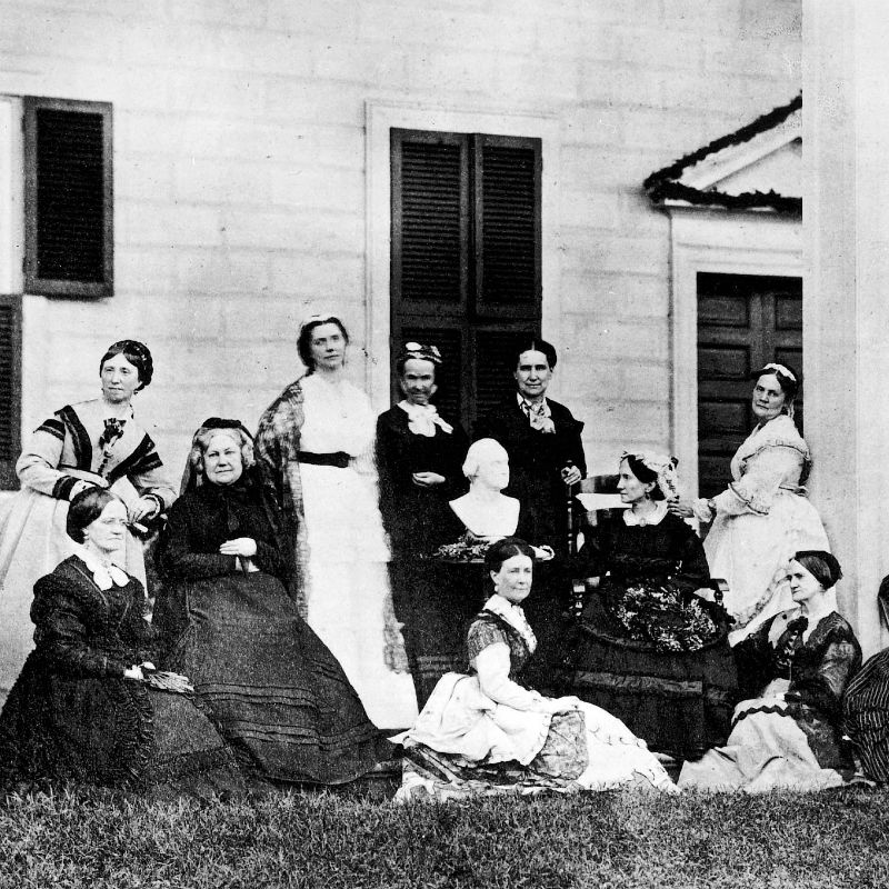
Ann Pamela Cunningham pioneered the historic preservation movement when she formed the Mount Vernon Ladies’ Association in 1853, and since that time, the Mount Vernon Ladies’ Association has been at the forefront of preservation philosophy, practice and technology. It’s with that same pioneering spirit that Mount Vernon has let the way with sophisticated technology including a custom digital model of Mount Vernon accessible through the Historic Building Information Model (HBIM) of George Washington’s home.
Previous episode